

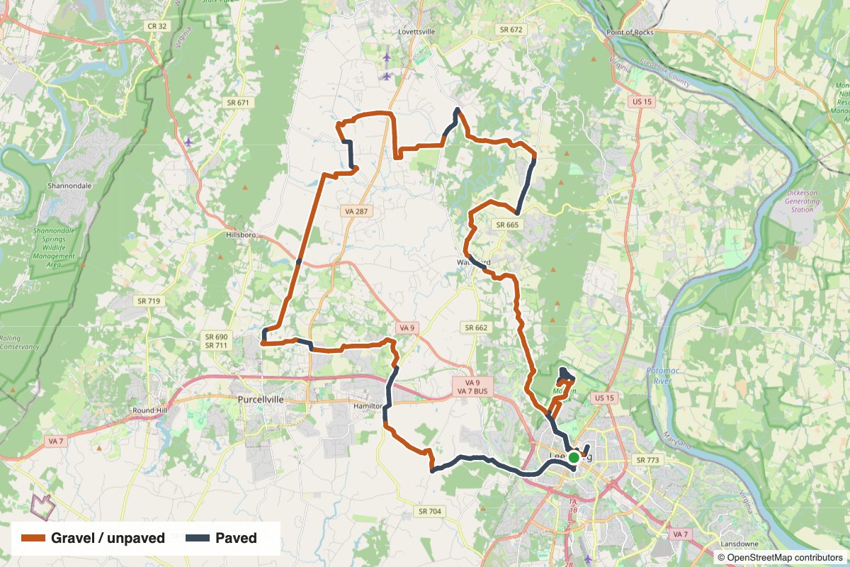
Leesburg Velopigs 80K is a 50.2-mile loop starting in Leesburg, with 3,770 feet of climbing. About 31.7 miles (63%) are on gravel or dirt roads and 18.5 miles are paved. The longest unpaved stretch runs 5.1 miles on Old Waterford Road near Waterford.
Route snapshot
What to expect
This loop spreads its gravel evenly across the ride: 14.8 gravel miles in the first half and 16.9 in the second. Along the way it links Waterford and Morrisonville.
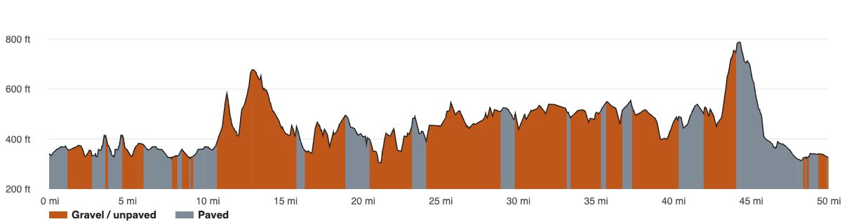
The course tops out at 788 feet around mile 44.5 and drops as low as 304 feet. Expect 15 climbs of 80 feet or more; the biggest gains 338 feet over 1.5 miles starting near mile 43.0. The steepest quarter-mile averages about 9.9% near mile 11.2. At roughly 75 feet of climbing per mile, we rate it advanced.
- 5.1 miles of continuous gravel on Old Waterford Road near Waterford.
- More unpaved stretches on Rickard Road and Purcellville Road.
- 63% of the distance is on gravel or dirt.
- Paved connectors include Old Waterford Road Northwest, Southern Planter Lane, Main Street, Loyalty Road and Milltown Road.
- A steep pitch of about 9.9% near mile 11.2. Choose gears that let you stay seated on loose gravel.
- At 50.2 miles, plan your water and food before you leave Leesburg.
Ride notes. Start and finish in Leesburg. These are working farm roads shared with horses, tractors and local traffic: slow down and pass wide around horses, and see VeloSafe for more. Gravel changes with the weather, so expect loose stone after a fresh grading and soft spots after heavy rain. Spring and fall are our favorite seasons out here.
Elevation and surface
Gravel sections
Unpaved stretches of half a mile or more, in riding order:
- Mile 1.3–2.8 (1.5 mi): Town Gate Lane, Governor Davis Lane
- Mile 4.7–6.2 (1.5 mi): Governor Davis Lane
- Mile 8.6–9.3 (0.7 mi): North Street Northeast
- Mile 10.8–15.9 (5.1 mi): Old Waterford Road — near Waterford
- Mile 16.5–19.1 (2.6 mi): Clover Hill Road — near Waterford
- Mile 20.7–23.4 (2.7 mi): Featherbed Lane
- Mile 24.5–29.1 (4.6 mi): Rickard Road, Bolington Road, Picnic Woods Road — near Morrisonville
- Mile 30.0–33.4 (3.4 mi): Purcellville Road — near Morrisonville
- Mile 33.9–35.5 (1.6 mi): Purcellville Road
- Mile 35.9–37.2 (1.3 mi): Allder School Road
- Mile 37.8–40.6 (2.8 mi): Piggott Bottom Road
- Mile 42.2–44.2 (2.0 mi): Digges Valley Road, Canby Road
Get the route
Surface data comes from Strava. Road names come from OpenStreetMap. Gravel roads change with weather and maintenance, so check conditions before you ride and follow our VeloSafe guidance on rural roads.
